Satellite Images Show Manhattan-Sized Ice Island Breaking Away From Greenland Glacier
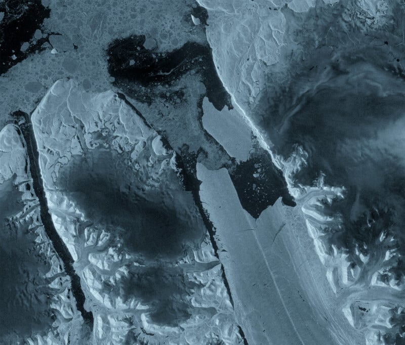
New satellite images show an ice island about the size of Manhattan breaking away from a Greenland glacier, marking the largest loss of floating ice there in over 10 years.
The European Space Agency’s (ESA) Copernicus Sentinel-1 mission has captured satellite images showing a major change at Petermann Glacier in northwest Greenland, where a 29-square-mile section of the glacier’s floating ice tongue of the glacier’s floating ice tongue broke away on August 4. Petermann Glacier connects the Greenland ice sheet to the Arctic Ocean.
The event marks the glacier’s largest loss of floating ice since 2012 and the most significant calving event in the Arctic since 2020.
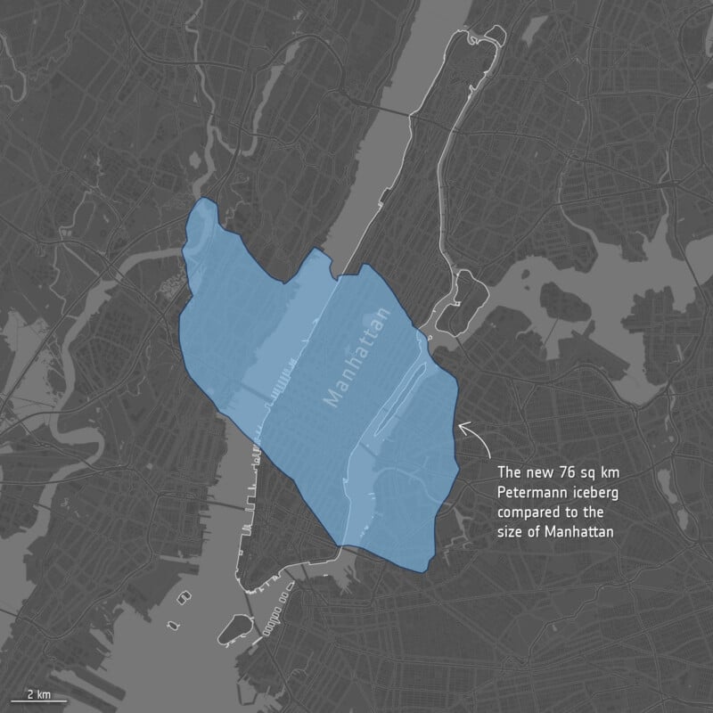
The newly formed tabular iceberg, or “ice island,” covers an area roughly comparable to Manhattan and is estimated to be up to 492 feet thick. The iceberg will now be tracked as it drifts and breaks apart, and scientists will monitor whether it affects shipping routes.
As Space.com reports, the effects of climate change on the planet’s ice sheets are well documented. Antarctica has lost around 5,000 square miles of grounded ice over the past three decades, while rising ocean temperatures continue to accelerate the loss of Arctic ice. Unlike grounded ice, melting floating sea ice does not directly raise sea levels, but the broader loss of ice contributes to a warming climate and can accelerate the retreat of glaciers and ice sheets.
The latest calving is unlikely to be the last major change at Petermann Glacier. Two further large ice islands, with estimated surface areas of approximately 97 and 87 square kilometers, could detach as existing rifts continue to propagate across the floating ice tongue.
Anna Crawford of the University of Stirling says that satellite images and the study of Arctic ice islands can help scientists understand how their breakup affects glaciers, sea-level rise, and the wider ocean environment.
“While large, tabular icebergs are relatively common in the Southern Ocean around Antarctica, Arctic ice islands are far rarer,” Crawford says in a statement for the ESA.
“By studying Arctic ice islands, we will gain knowledge that can be transferred across polar regions. This is critical for understanding how the calving and deterioration of ice islands impact glacier dynamics, sea-level rise and the ocean environment.”
Affiliate Disclosure
PetaPixel articles may include affiliate links; we may earn a commission if you buy through one.